The Geospatial-microplanning project aims to transform microplanning using GIS technology. Users can easily upload various data formats and customize microplans to suit their requirements.
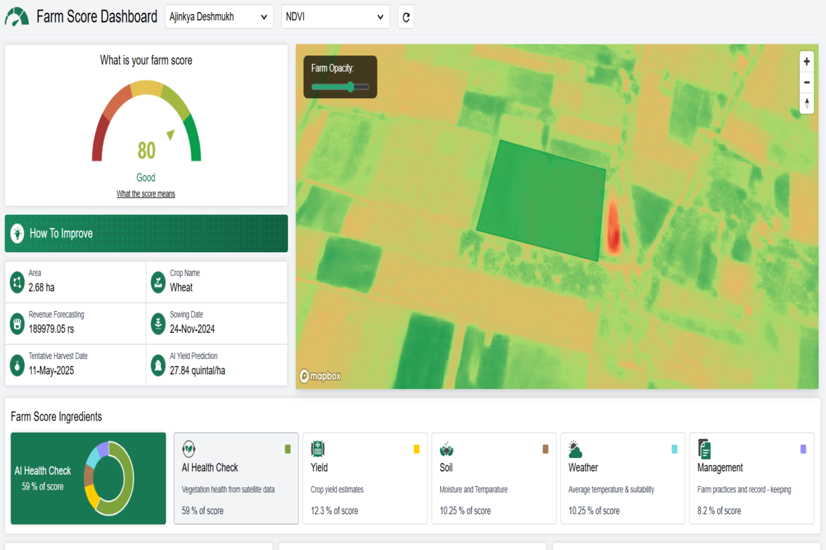
Farm Score Dashboard is a smart, automated platform that helps farmers access fair and timely credit and insurance. It also provides risk insights to reduce crop losses from floods, droughts, and heatwaves. Designed especially for smallholder and marginal farmers, it supports climate-resilient agriculture.
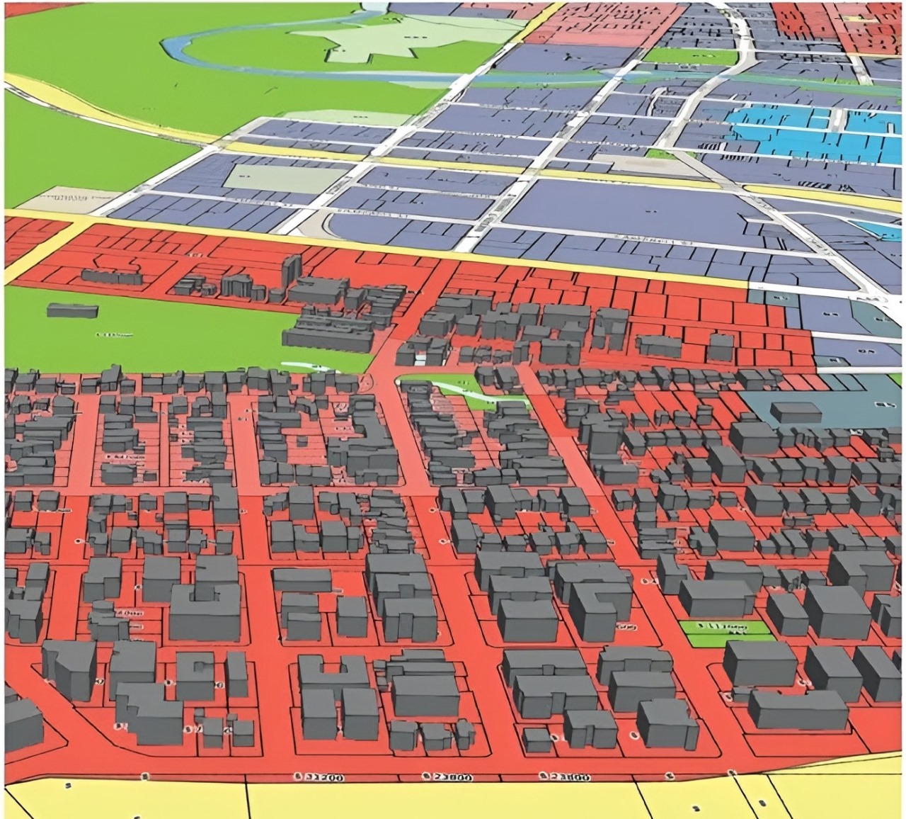
GIS processing in the real estate industry enables precise mapping of property boundaries, zoning regulations, and demographic data, facilitating informed decision-making for site selection, market analysis, and urban planning.
Do you have similar development requirements?
Collaboratively administrate empowered markets via plug-and-play networks dynamically procrastinate